
Before You Go

- There is no park fee. East Sooke Regional Park is managed by the Capital Regional District and is free to access. No day pass, no reservation required. Even the parking is free!
- Getting there from Victoria takes about 45 minutes. Head west on Highway 14 through Colwood and Langford, then follow East Sooke Road down toward the park. The main entrance and parking lot is at Aylard Farm on Becher Bay Road. There is also a parking lot at Pike Road on the other side of the park if you're hiking into Iron Mine Bay from that direction.
- You need a car. There are very limited transit options in East Sooke Regional Park, and they are set up more for the residents rather than people visiting the popular sites and trails.
- The park is open year-round. Summer and early fall are the best times to visit, especially if you want to swim at the beach near Creyke Point. The coastal trail gets exposed and wet in winter, and the rocky sections get slippery.
- Bring everything you need. There are no services inside the park. No café, no water tap, no gift shop. Pack lunch, snacks, plenty of water, and sunscreen. The one exception is Hide N Seek, a food truck set up next to the one and only general store.
- Wear proper footwear. Trail runners or sturdy sneakers are fine for the Creyke Point to Aldridge Point section. If you're planning a longer day on the coastal trail, wear hiking boots.
- Check the wind before you go. The coastal sections are exposed, and on a windy day, the gusts off the Juan de Fuca Strait can make the rocky headlands pretty uncomfortable. If it's blowing hard, Matheson Lake is a sheltered alternative further inland.
Where to Stay (Before It’s Fully Booked)
A Bit of History
First Nations people used this coastline for centuries, gathering oysters and fishing along the same shores you'll be hiking. The petroglyphs near Aldridge Point are still visible today and worth seeing on your way through.
In more recent history, the area was home to logging operations, small copper mines, and salmon traps before the park was established in 1970. It covers 14.3 square kilometres of protected land and looks directly across the Juan de Fuca Strait at Olympic National Park in Washington State.
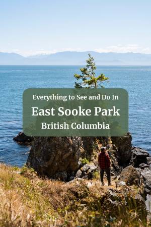
Creyke Point: Start Here

The Aylard Farm parking lot is where most people begin their day, and Creyke Point is the obvious first stop. It's a 15 to 20-minute walk from the lot, and it's the best viewpoint in the park. A rocky headland looking south across the strait toward the Olympic Mountains, and on a clear day, the view across the water is hard to beat.
Whatever else you do today, start here.
The Beach Near Creyke Point

Just past Creyke Point along the coastal trail is a white sand beach that is the best spot in the park for swimming and hanging around. It's about a five-minute walk from the point, and you'll catch glimpses of it through the trees as you walk the path.
You'll see a few steep, informal paths cutting down to the beach through gaps in the trees. Skip those. Keep walking a little further, and there's a proper wooden ramp that gets you down to the beach easily.
The water is cold but swimmable in summer, and the beach is sheltered enough to be a good spot to set up for a few hours. This is also one of the rare white sand beaches in the area, which is a nice break from all the rocky beaches along the coast that are a bit harder to get comfortable on with just a towel.
The Coastal Trail: Creyke Point to Aldridge Point

If you want to keep moving after the beach, the coastal trail continues east toward Aldridge Point and is worth adding to your day.
The section from Creyke Point to Aldridge Point is the most accessible stretch of the longer coastal trail. The path is wide, mostly flat, and well-defined with only the occasional root to step over. It alternates between coastal forest, which cuts the wind, and open rocky headlands where the views open right up. The outcrops along this section are worth walking out onto.
To be totally honest with you: once you've seen two or three of these headlands, you'll notice they're all spectacular but telling a similar story and that Creyke is the most dramatic. The trail gets more interesting the further you go if you're committing to the full coastal route, but for most people, the Creyke to Aldridge section fills your cup well enough.
Past Aldridge Point, the trail changes character. More scrambling, more technical footing, more time looking at your feet instead of the view. Still manageable if you're used to BC hiking, but that's roughly where it goes from a walk to a hike.
Normally, in BC, I like to follow a specific AllTrails route, but in this area, it actually makes a bit more sense to download the map offline and just make up your own little loop based on your interest and how challenging you want to make your hike. Take a look at the map for the full coastal trail and map out how much you want to bite off. I personally think the best effort to reward ratio is just looping between Creyke Point, down to the Aldridge Point Petroglyphs, then cutting back through the forest toward the car park.
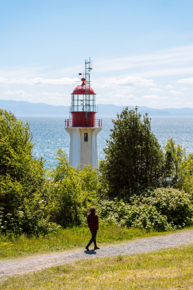
The Aldridge Point Petroglyphs

Before turning back toward the parking lot, walk out to Aldridge Point and look for the petroglyphs carved into the rock face.
They take a moment to find. The rock surface has weathered over time and collected lichens and dirt, while the carved lines have stayed smoother, so they show up as faint pale marks against the darker rock. The most recognizable figure is a large animal, possibly a seal, in profile. Other figures are nearby but harder to read due to erosion.
They're estimated to be anywhere from 200 to 3,000 years old. The range alone tells you how little is known about them.
Lunch: Hide N Seek Food Truck

Hide N Seek is a food truck doing Asian comfort food with a good patio setup. It's a solid lunch stop, and between the price, the patio, and the quality of the food, you really can't go wrong. It's honestly one of my favourite places to eat in the entire Sooke area.
Right next door is a well-stocked general store where you can grab drinks or anything you forgot to pack. Between the two, the lunch situation at East Sooke is well sorted.
Iron Mine Bay: The Second Best Spot in the Park


If you've got more time after lunch, Iron Mine Bay is worth making a dedicated effort to see. Rather than hiking the full coastal trail from Creyke Point, the better move is to drive around to one of the two trailheads that access the bay directly.
- From the Pike Road Parking Lot is the most popular approach. The trail is 4.3 kilometres with about 76 metres of elevation gain and takes between one and one and a half hours at a comfortable pace. The terrain is mostly flat, and the trail is well-maintained.
- The Silver Spray Trailhead is shorter, but you'll need to park outside Sookepoint Ocean Cottage Resort and walk up a dirt road for about five minutes to reach the trailhead. You'll pass some construction equipment and general clutter on the way, which is a bit of a vibe killer. Once you hit the trailhead, you're back into the forest, and it's fine.
Both routes end at Iron Mine Bay Beach, a pebble beach tucked between two large rocky cliffs. It's a more rugged and remote feeling beach than the one near Creyke Point, and it's a good payoff for the hike. That said, because of the effort to get in, it's not really practical to bring everything for a full beach day. If lounging is the goal, the Creyke Point beach is the better option.
From the beach, you can climb up onto the rocky cliff on the left for a good view back along the coast. Some of the rocks get slippery when dry in summer, so watch your step. If you want another viewpoint, skip the beach turnoff and continue along the Pike Trail to Pike Point instead.
Matheson Lake: The Easy Option

If the wind is bad on the coast, or if someone in your group wants an easier day, Matheson Lake is a good alternative. It's on the inland side of the park and well-protected from the coastal wind.
It's a classic BC lake with clear water and a forested shoreline. The water warms up in summer, and it's a good swimming spot. The loop trail around it is flat, well-maintained, and an easy walk. There's also a small island in the middle of the lake that people kayak and paddleboard out to.
It doesn't have the same impact as the coastal spots, but it's a nice afternoon if you're after something low-key.
How to Plan Your Day

- If you want the highlights without a big hike: Aylard Farm parking lot, walk to Creyke Point, spend time at the beach, loop out to Aldridge Point for the petroglyphs, then lunch at Hide N Seek. About four hours total. This is the right call for most people.
- If you want a full day: Do the Creyke and Aldridge section in the morning, lunch at Hide N Seek, then drive around to the Pike Road lot and hike into Iron Mine Bay in the afternoon. You'll cover the two best spots in the park.
- If you want something easy: Skip the coastal trail and go straight to Matheson Lake. Loop the lake, swim if it's warm enough, and make a slow afternoon of it.
Where to Stay
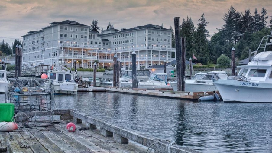
Sooke Harbour House is our top pick as a base for this itinerary and one of the better properties on the South Island. It sits right on the water overlooking the Whiffin Spit. The restaurant has a strong reputation, and the location puts you within easy reach of all three days of activities. Book well in advance for summer weekends.
There are a few other high-end options in town as well:
Prestige Oceanfront Resort, WorldHotels Luxury
A polished, full-service resort option with oceanfront views and all the amenities you'd expect from a luxury hotel brand. Great if you want reliable comfort, an on-site restaurant, and easy access to town without sacrificing the coastal setting.Check Availability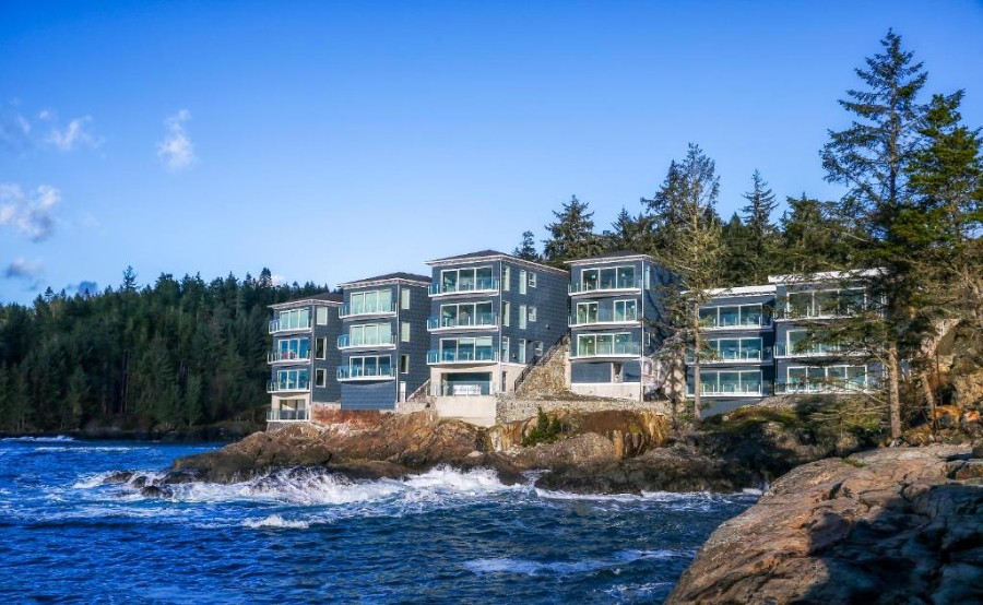
SookePoint Ocean Cottage Resort
For something a little more intimate, SookePoint offers private ocean cottages that feel far removed from the everyday, even though you're right on the coast. A fantastic choice for couples or anyone who wants that "waking up to the ocean" experience with a bit more privacy and independence than a traditional hotel.Check AvailabilityTravelling with kids, extended family, or a group? Renting a full townhouse gives you the space to spread out, a kitchen to prep your own meals, and a home base that actually feels like home. Sooke has several solid options available:
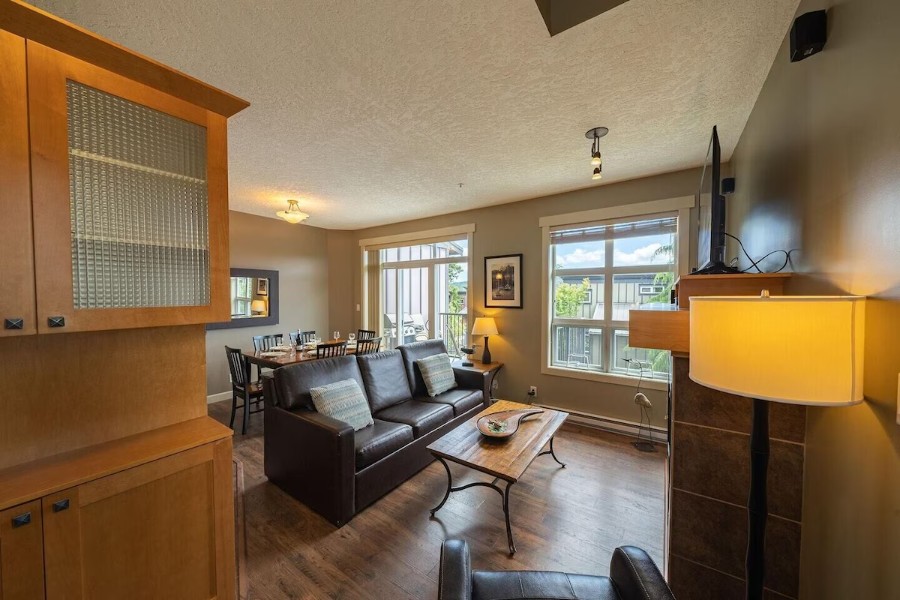
2 Bedroom Sooke Townhome
Check Availability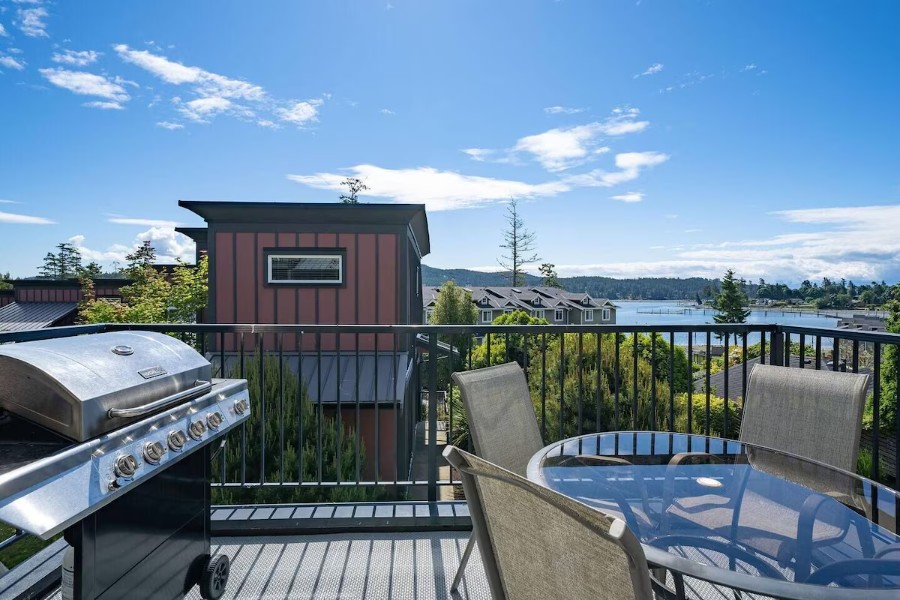
Sooke 2 Bedroom Townhouse
Check Availability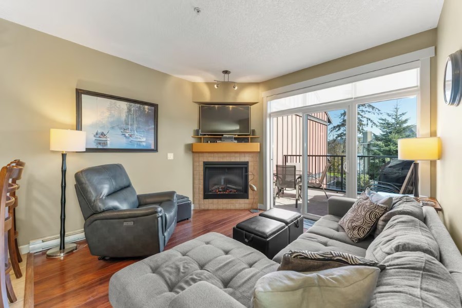
Spacious 3 Bedroom Townhome, Sooke, BC
Check AvailabilityIf you're drawn to Sooke for the slower pace and want to lean all the way into that cozy, off-the-beaten-path feeling, Woodside Farm Country Inn is a gem. Set on a working farm in a peaceful rural setting, it's the kind of place that makes the whole trip feel like a proper escape. Farmhouse charm, birdsong in the morning, and absolutely no reason to rush anywhere. Highly recommended for couples or solo travellers looking for a restorative retreat.
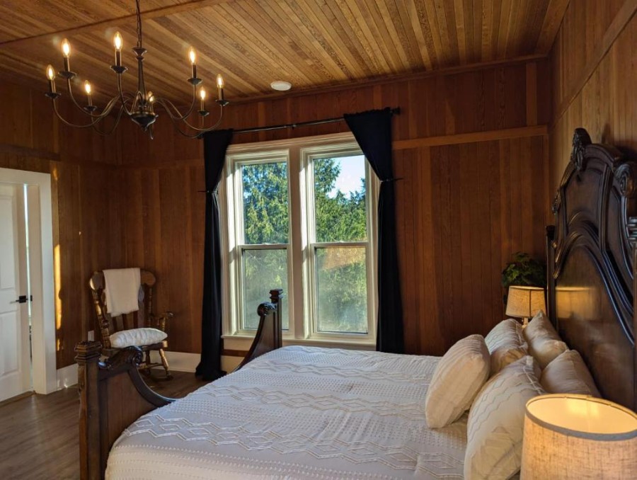
Woodside Farm Country Inn
Check AvailabilityIf you really want to commit to the wild side of Sooke, this one's hard to beat. This entire home sits right inside East Sooke Regional Park.
Imagine finishing a hike on the Coast Trail and walking back to your own front door. Morning coffee on the deck with nothing but forest and ocean air around you. Stargazing without a streetlight in sight.

Entire Home In East Sooke Park
Check AvailabilityFinal Thoughts

There's more to East Sooke than you can see in a single day, and most people who go once end up back within a few months. If you're in Victoria and want one day out of the city that feels properly wild, this is the one to do.
This park is great, but it's also just the tip of the iceberg. Past Sooke highway 14 continues all the way to Port Renfrew at the end, with incredible hikes, waterfalls, campsites, and viewpoints dotted along the windy, narrow highway. Check out our comprehensive guide to help plan your road trip. If you can extend your day trip and spend a few nights in Sooke, it is a great base for exploring the entire south coast.
FAQ
Is there a fee to enter East Sooke Regional Park?
How hard is the East Sooke coastal trail?
Where should I start my day at East Sooke Regional Park?
Is there anywhere to eat at East Sooke Regional Park?
What are the petroglyphs at East Sooke Regional Park?
Our Trusted Travel Partners
We only recommend products and services we personally use and trust.

SafetyWing
Travel medical insurance for nomads and remote workers
Booking.com
Find the best deals on hotels, apartments, and vacation rentals
AllTrails
Discover hiking trails with detailed maps and reviews
Surfshark
Secure VPN for safe browsing and accessing content worldwide
Get Your Guide
Find the best deals on tours and experiences
Airalo
Prepaid SIM cards for travelers
Trusted Housesitters
Find free accommodation by house and pet sitting worldwide
Wise
Send and receive money internationally with low fees* We may earn a commission when you make a purchase through our affiliate links, at no extra cost to you. We appreciate this support, which helps sustain our blog and allows us to create more content and help more great trips get planned!